

Including Topography, Orthomosaics, Quantities, Cut/Fill Site Monitoring, Aerial Imagery, Aerial Surveying & DEM Files. All tied into state plane coordinates with ground control points. F.A.A. Certified Remote Pilot (SUAS)
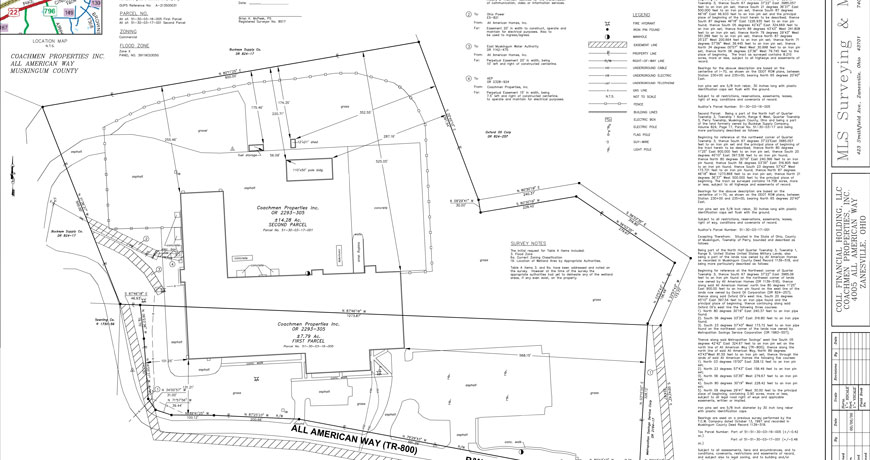
ALTA Survey is a land survey made for the Title Company and/or Lender with the survey and location data needed for the issuing of title or mortgage insurance. For this purpose a map is drawn to ALTA specifications. ALTA stands for American Land Title Association. ALTA specifies the data to be shown on the survey and this includes boundary lines, location of the main building including improvements, location of ancillary buildings, the identification of easements (access rights by service companies such as water, gas, telephone, railways and other utilities).
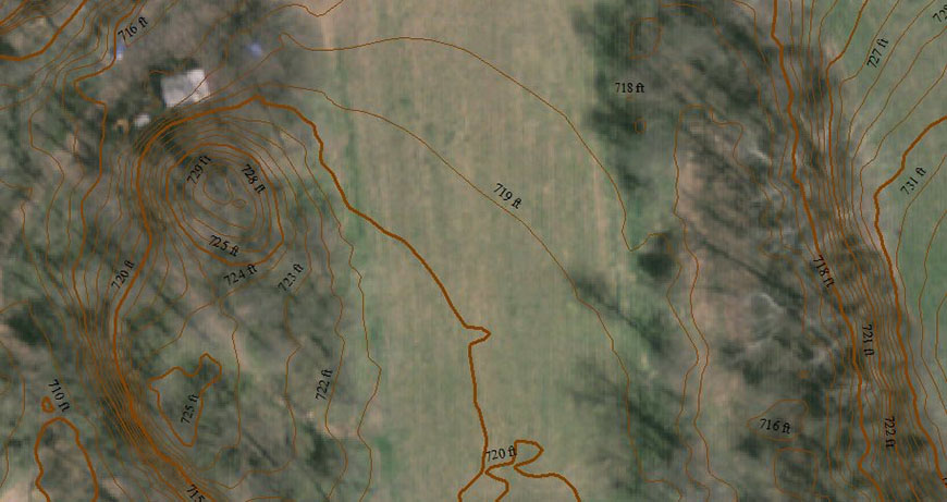
Topographic Surveying is a survey that measures the elevation of points on a particular piece of land, and presents them as contour lines on a plot.
Boundary surveys are defined as surveys made to establish or to retrace a boundary line on the ground, or to obtain data for constructing a map, plat, or report showing a boundary line.
Surveying has been an essential element in the development of the human environment since the beginning of recorded history (about 6,000 years ago). It is required in the planning and execution of nearly every form of construction.
A mortgage location survey shall be defined as an instrumentality, common to the mortgage lending industry, whereby substantial proof is submitted to the mortgage lender and/or title insuror that the building(s) and/or other improvements are actually located on the land covered by the legal description in the mortgage and that said mortgage location survey is a professional service provided by professional surveyors solely for the intent of and use by the mortgagee and/or title insuror.
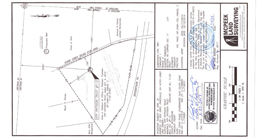
McPeek Land Surveying specializes in providing our clients with a map to assist in the permitting of new gas and oil wells.
Real estate investors, developers, and even residential property owners who want to know specifically what they are buying or what they already own will often commission a survey. The survey will establish with precision the property lines and locate any structures on the property. And it will also locate any easements which impact the property, such as utility easements and rights of way.
Surveyors most familiar modern uses are in the fields of transport, building and construction, communications, mapping, and the definition of legal boundaries for land ownership. Whenever there are roads, railways, reservoir, dams, pipeline transports retaining walls, bridges or residential areas to be built, surveyors help determine the placement of structures. They establish the boundaries of legal description.
When used by skilled professionals, GPS provides surveying and mapping data of the highest accuracy. GPS-based data collection is much faster than conventional surveying and mapping techniques, reducing the amount of equipment and labor required.
Flood maps are issued by The Federal Emergency Management Agency (FEMA) as an end result of a general study of a large area.
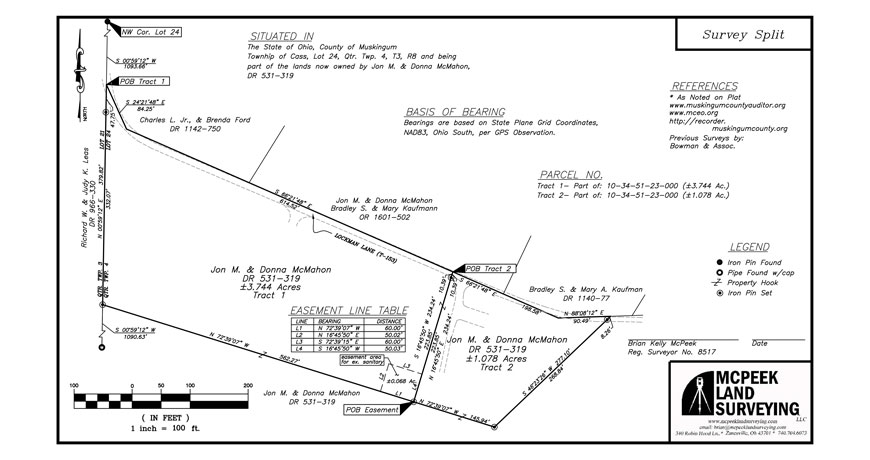
Lot split surveys, or minor subdivision surveys, are completed when an owner desires to split a parcel of land into two parcels.
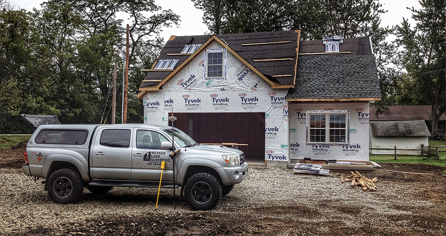
A Foundation Survey is a survey done to collect the positional data on a foundation that has been poured and is cured. This is done to ensure that the foundation was constructed in the location, and at the elevation, authorized in the plot plan, site plan, or subdivision plan.
As-built survey is a survey carried out during or immediately after a construction project for record, completion evaluation and payment purposes. An as-built survey is also known as a 'works as executed survey' and documents the location of the recently constructed elements that are subject to completion evaluation. As built surveys are often presented in red or redline and overlaid over existing design plans for direct comparison with design information.
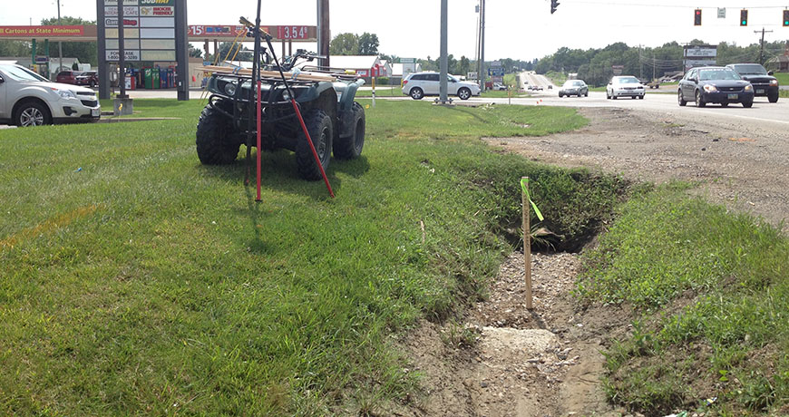
A Route Survey is a survey for determining the route, grades, etc., of a railroad, highway, or power line.
A Foundation Survey is a survey done to collect the positional data on a foundation that has been poured and is cured. This is done to ensure that the foundation was constructed in the location, and at the elevation, authorized in the plot plan, site plan, or subdivision plan.
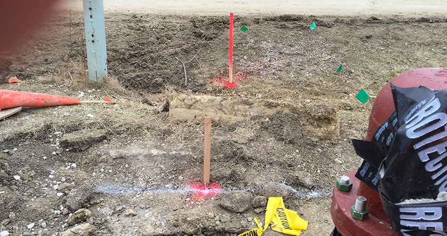
To ensure that a proposed structure is correctly positioned on the property, the surveyor can set wooden stakes at the major building corners, or, if desired, at every turn in the foundation.
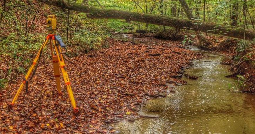
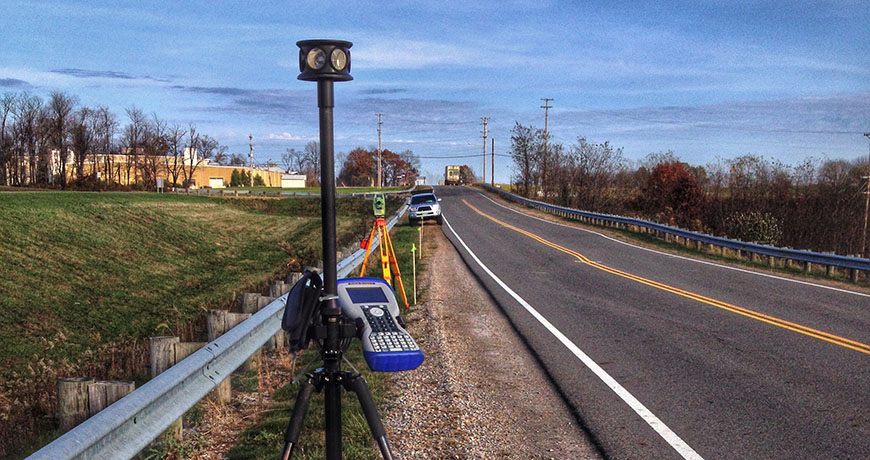
Electronic / optical instrument used in modern surveying and building construction. The total station is an electronic theodolite (transit) integrated with an electronic distance meter (EDM) to read slope distances from the instrument to a particular point.
Robotic total stations allow the operator to control the instrument from a distance via remote control. This eliminates the need for an assistant staff member as the operator holds the reflector and controls the total station from the observed point.
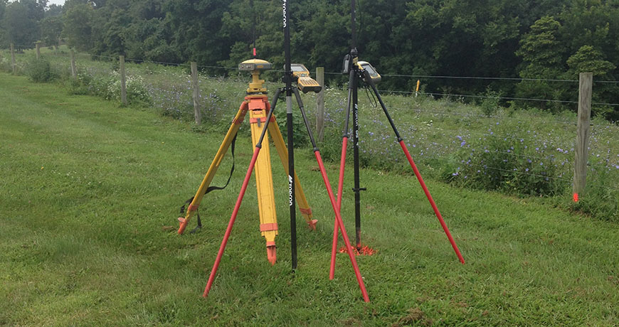
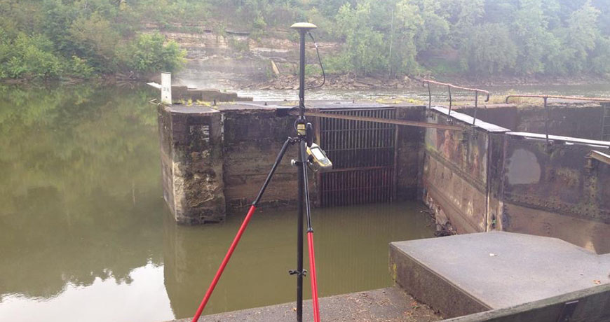
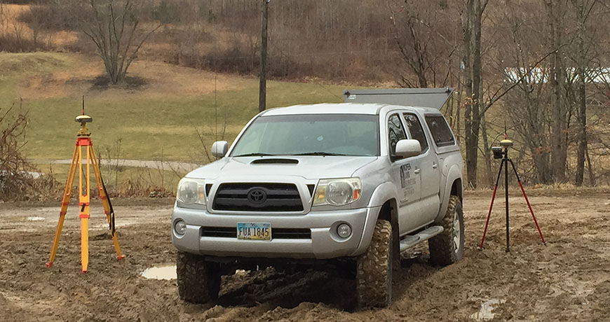
Real Time Kinematic (RTK) satellite navigation is a technique used to enhance the precision of position data derived from satellite-based positioning systems, being usable in conjunction with GNSS (GPS, GLONASS, Galileo, Beidou).
Land surveyors use Land Surveying Software to increase efficiency, accuracy and productivity.